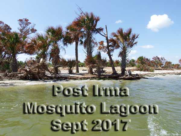
Mosquito Lagoon / Cape Canaveral Shores Canoe and Kayak CampingI'm more of a scuba diver but from time to time, we use our boats, canoes and kayaks to access places we can do some unique diving. Because of this we discovered Mosquito Lagoon years back, and now its a regular pastime to just camp there.
There is magic in camping. On Mosquito Lagoon, the magic is enhanced by the water, wildlife and scenery. After camping the lagoon a few times, I was 'inspired' to write this article up to encourage others to try it and if they do, provide them with information and some of my experiences.
The island campsites, 14 of them, are officially available by permit only. However, we witnessed, many times, people camping without a permit; sometimes very near our permitted campsite. Lots of 'day timers' in your 'space' too. There is obviously a problem with enforcement of compliance to permitting. I don't recommend you NOT get a permit to camp, just don't expect everyone to follow that rule.
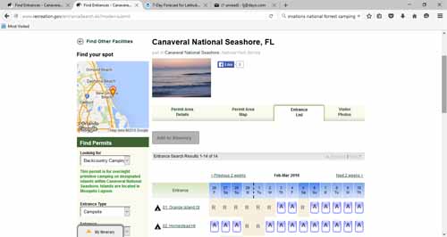
A permit is required and there is a fee. As of January 1st, 2016, you can do all the reservations online. They price went up a bit, now its $20/night, but the convenience is worth it. Link to Online Reservations site,
You may print your permit 14 days before your reservation date and cannot make changes to the permit once you have printed it.
You must print out enough copies of your permit to have one with you on the island for your group, and one on the dash in each vehicle associated with your group. This Backcountry Camping permit does not include the entrance fee for the park.If you go onto the park, be sure to bring receipts, printed from your online reservation, so you are charged correctly. Keep a copy of your receipts on you, in your car window, and at your campsite. You do not have to check out.
You can rent canoes from the park, $25/night, for campsites #1 thru #5 only. To inquire about that you can call the Visitor Center at (386) 428-3384 ext.0.
There are two spots you can safely leave your vehicles. Remember to never leave anything of value showing in your parked vehicles. One is just inside the park, on the right. You have to pay extra though. Be sure to pay for that parking, at the gate, when you arrive.
The other parking area is at the River Breeze Park in Oak Hill. Parking here is free and we have never had any issue with security there. River Breeze Park (Boat Landing) address: 250 H.H. Burch Road, Oak Hill, Open daily: Open 24 hours. Admission: Free Link to their website
Campsites 1 thru 5 are best accessed from the Cape Canaveral Shores Park's boat landing. The rest are better accessed from River Breeze.
There are NO facilities on these islands, except for a fire pit, and a picnic table.They would like you to use the fire grates. They aren't always located in a good place though. Be careful if you start a fire elsewhere, and check with the rangers when you pick up your permit about that.
There are rules about cutting down trees for firewood. You can't! There is, usually, driftwood and fallen limbs/trees that you can collect, however, I've always brought most of mine. This usually means an extra trip from our vehicles, but nice firewood, cut and ready is nice. I like a nice fire, especially on those cool nights. In the summer, I think the smoke helps keep the bugs away.
If you move the picnic table to a more practical location (because of wind for example), be sure to return it to its original location upon leaving. Take trash bags and take all trash with you when you leave. Leave nothing but footprints! That's pretty much it since you are NOT close to any other (permitted) campers.
The raccoons are too familiar with campers. That means if you leave something out they can eat, they will find it. They haven't figured out how to open our ice chests yet (they can on Bahia Honda campground in the Keys). On campsite island #10 and #12, they were rather persistent, but when the dogs are with us, they don't come by.
Many of the islands are called 'Spoil Islands'. That term is derived from the dredging done in making the intracoastal waterway. They can all be accessed by motor boat, canoe and/or kayak. Other natural islands, like Shipyard, Orange, and Plantation, even have some history. More about history can be found here .
What to take? I'm always accused of taking everything in my canoes and kayaks. Definitely take a cell phone in a dry bag. There is a list at the bottom of this page.
What to do? Sites to see. There are lots of kayak and canoe 'trails' in the lagoon. You can always find your own too. The park's maps are terrible, so I often use google maps with satellite, on my android, to navigate.
You can access the beach from the park's boat ramp or at the one down by parking lot #5. If you walk south on the beach at parking lot #5, you will see people without clothes. That can be exciting if you send someone down there that won't expect it. There is the Eldora house. Its what's left of the homes that once existed in a small community on what's now the park property.
Turtle Mound is a historically interesting place and one of the largest middens in the area. A midden is a dump of sorts. After years of dumping mollusk/oyster shells on this spot, the indians that lived here have left us proof of their existence. It provides a great view of the area.
Lots of wildlife! You'll see raccoons, birds, dolphins and manatees (year round even). I've seen, once, a bear with cub. You'll occasionally see deer, and sometimes a bald eagle.
You can take your pets, but be careful. Lots of predators around if your pet is small. I've taken my labrador and chihuahua but I don't let the little guy out of my site, but I doubt I'll take him again. The labrador loves the water and camping!
There is a restaurant! For dinner, lunch or breakfast, try Goodrich Seafood Restaurant at 253 River Rd, Oak Hill, FL 32759.
Its on the water. You can park your boat there. Its located north of Oak Hill Fish camp and south of River Breeze Park (between campsite 8 and 9).Near campsite #3, on the northeast side of the park is JB's Fish Camp. Always busy and easy to access from that side of the park!
Right beside River Breeze Park, on the northwest side, only a few hundred feet from the landing is a friendly bait shop (Indian Mount RV & Fish Camp), with ice and very basic supplies.
What seasons are best? I've camped there in June, July and August. Its hot and lots of bugs (unless its windy). Bugs can be bad, so be prepared. Fortunately the water is warm (one good way to escape). I will camp in the summer, but I'll bring my bug repellent and tiki torches! Remember the name of this place: Mosquito Lagoon. The best camping season, in my opinion, is the winter months, after the first cold spell, usually November thru early spring (late March or early April). Regardless of the season, always check the weather. Rain, cold, and wind are important factors here. Wind is a big issue if you have small craft and plan to camp on islands 11 thru 14. Fortunately in regards to wind, all these campsites have options as to where you can put your tents. Find a sheltered site, surrounded by trees. You can also, put your tent behind a slope on some of the campsites. The most obvious tent sites are not always the best.
Fishing? This place is famous for Redfish fishing. A good catch can make a nice dinner too. Be sure to have your salt water fishing license with you.
Descriptions/write up of each island campsite:
# 1 Orange Island, OI, N 28 54' 46.6" W 80 49' 45.6" - Capacity 6
This campsite is on the north east side of Orange Island, just across the water from the Eldora Hammock house. I won't camp here if I have a choice. Its too 'public'. Lots of island to explore, with thick vegetation, though. It is close to the park's boat landing.
Campsite #1 - Google Maps Area Satellite Map Above, Closeup Below
# 2 Homestead Island, HI, N 28 54' 59.0" W 80 50' 17.2" - Capacity 8
This site is just west of campsite #1. I like this site, but it was booked every time I tried to get it. I think this will be a great place to camp in the winter months. You can find me there this winter. This will be our first choice on our first camping trip.
There is a canal just east of the campsite that lets you canoe/kayak the little canals that once was an orange grove. Don't get turned around in there. Its easy...
Campsite #2 - Google Maps Area Satellite Map Above, Closeup Below
# 3 Shipyard, SY, N 28 56' 27.3" W 80 50' 41.3" - Capacity 10
This is the closest campsite to the park's boat landing. It is also close to civilization. Just look up and north at the tall condos. There is an Island to explore here and lots of room to put up tents. South and west of here are channels that you can explore in a kayak or canoe. There used to be canoe/kayak trails around Shipyard Island. They are still there, just not maintained in years. After one dead in (fallen tree), I didn't try any others. Its a bit of a maze (like behind Orange Island), so don't get lost or turned around if you try it.
Campsite #3 - Google Maps Area Satellite Map Above, Closeup Below
# 4 Headwinds, HW, N 28 56' 16.6" W 80 50' 41.5" - Capacity 10
I never landed here, but the google maps makes me think its much like campsite #3. I believe the camping area is a bit away from the shore. Once when I was passing this site, two campers were wading in the water about 1500 feet away from their kayaks. I thought that was odd. I drove by and waved. I didn't want to tell them that bull (and other) sharks leave their young in the lagoon. Like #3, this place is very close to civilization. I don't want to see condos just across the way when I camp.
Campsite #4 - Google Maps Area Satellite Map Above, Closeup Below
# 5 Government Cut, GC, N 28 57' 02.3" W 80 51' 52.0" - Capacity 20
From the water this site looks like its on a sandbar. I think that is just an allusion though. Its probably because none of the trees here are big. There is plenty of space for tents, but because the trees are not much bigger than tall shrubs, I don't think I would ever camp here, but aside from the occasional boat passing by (its next to the old intracoastal waterway), its pretty private.
Campsite #5 - Google Maps Area Satellite Map Above, Closeup Below
# 6 Jones Canel, JC, N 28 55' 08.2" W 80 51' 32.6" - Capacity 20
This site is on Jones Canal, just off the intracoastal waterway. There is a buoy marker there (and sandbar) at the entrance to the canal.

This is a good campsite with plenty of tent side, huge trees covering everything and just off the intracoastal, so there is some privacy. You've got lots of island to walk about looking for things to burn too. Its not too far north of River Breeze park.
Campsite #6 - Google Maps Area Satellite Map Above, Closeup Below
# 7 Brickhouse Cove, BC, N 28 54' 55.7" W 80 51' 25.6" - Capacity 60
Campsite 7 is best accessed via Jones Canal, running by campsite 6. You can (carefully) drive a motorboat to the site via Jone's canal. You can also cross the shallows of Mosquito Lagoon from the east side of the lagoon (don't get lost, and its a long way). Another popular access option is taking the canal directly across from River Breeze Park. This is where I saw the bear with cub. Stay left up the east side of the spoil island. As you get close to the campsite, you'll have to maneuver northeasterly to get around the point there.
That point is also a crossroads of sorts for boats and wildlife. I often see manatees there. Campsite 7 is one of my favorites. It's located on the backside of a spoil island, and lots of room to make camp. There is even a bit of a hill there. The water in Jone's canal can be shallow and strong currents during tide changes. I recommend this site as one of the top choices. Its private aside from boat traffic, has a large clearing, and lots of places to put up tents. We've camped here and will return.
On the west side of this island, some un-permited campers set up camp once. When we return to this site, we'll put up a tent or old tent fly there, just a few hundred feet from our main camping site, to give the appearance that someone is already camping there. That works elsewhere sometimes too.
Campsite #7 - Google Maps Area Satellite Map Above, Closeup Below
# 8 Bissette Bay, BB, N 28 53' 39.7" W 80 50' 49.6" - Capacity 15Campsite 8 is located just across from the boat landing at River Breeze Park. Head southeast. Its less than a mile away. This island is very popular to the locals for day trips. Don't expect privacy at this site. It was not too bad for bugs the one time I camped there in June, but we did use a ton of bug spray. It was hot so we stayed in the water a lot. There is lots of room to put up tents here and plenty of shore. There is a sand bar off the beach here that you can often see locals parked on during the day. Its shallow! If I was to name this island, it would be PARTY ISLAND.
Campsite #8 - Google Maps Area Satellite Map Above, Closeup Below
# 9 Middle Dredge, MD, N 28 51' 58.3" W 80 49' 35.8" - Capacity 25
This site has two sides to it; west (intracoastal) and east. The main side is the east side, but if staying here, because daytimers might land on the west side, it might be a good idea to park your boat there or put up a tent.
If you have a large group, you will can put tents up on both sides. Lots of room here and its all under the cover of tall trees. Very shady in the summer, and protected in the winter from wind. This site is directly across from Oak Hill Fish Camp.
Campsite #9 - Google Maps Area Satellite Map Above, Closeup Below
# 10 South Middle Dredge, SM, N 28 51' 51.0" W 80 49' 29.0" - Capacity 25
This could be one of our favorite sites since there is lots of room, an open area, and good swimming in the summer, but this campsite has to be one of the worse for locals to hang out, on the opposite side of the island where we camped. They all explored the island and thus continued to walk through/by our campsite. I can not recommend this site if you don't like that. I didn't like the idea of leaving the campsite empty either. It was March when we camped there, but I'm always seeing daytimers there. There is a bluff on the back side, the popular side, that seems to attract visitors to stop and land. There is a little bay there to swim in too.
This island is a great jump off spot for boating. On the south side, where the main campsite is, is a little shallow cove that is fairly sheltered from the wind and waves from the larger bay just south of it. Lots of room for tents. Because the wind was blowing we put up the tents in the trees to the west side of the island.
Campsite #10 - Google Maps Area Satellite Map Above, Closeup Below
# 11 Scout Island, SI, N 28 51' 30.1" W 80 49' 35.6" - Capacity 20
This is where we camped last (in July). Too many mosquitos where the sign post was, so we set up the tents in the open area just a few hundred feet away. It was July the 4th weekend, so we got to watch all the fireworks (towards the north) from the little hill in the center of the island. It also rained a lot on this trip which probably didn't help the bug situation either.
Not a lot of tent spaces near the sign post here, but there is towards the center of the island. This was a good camping site. We will use it again given a chance. Manatees slept in the water just a few feet from our canoes every night.
Campsite #11 - Google Maps Area Satellite Map Above, Closeup Below
# 12 South Dredge, SD, N 28 50' 53.6" W 80 49' 14.0" - Capacity 40
This was the first island campsite I camped on. It was in December and very windy. We should have made camp on the backside of the island but we'll know better the next time. Notice the wind breaks in the picture below:
This site has a little hill/rise in the middle of the island, and a few resident raccoons. They ate our hotdogs one night. This campsite is well south of Oak Hill Fish Camp and because of the large bay just in front of it, the waves can get dangerously high for canoes. We didn't get to canoe on this trip and the trip to and from it was not pleasant. Lots of island to put up tents in. We put our tents up by the fire pit, on the point (south east corner, directly in the wind). We had to put up rocks to make a wind break for the fire pit.
We had a good camping experience though and even had our friend anchor his yacht off the island for a night. He didn't camp, but he did come visit the island to let his dog walk about.
Campsite #12 - Google Maps Area Satellite Map Above, Closeup Below
# 13 East Winds, EW, N 28 50' 41.3" W 80 49' 05.4" - Capacity 20
This is a roomy island. Like campsite 14, there is a little cove you can park your boat(s)
Campsite #13 is a good ways south of Oak Hill Fish Camp and has the huge bay in front of it. Getting to/from this island can be a challenge for canoes and kayaks in strong winds.
Lots of room and tent spaces on this island. I would camp here.
Campsite #13 - Google Maps Area Satellite Map Above, Closeup Below
# 14 County Line, CL, N 28 50' 26.9" W 80 48' 56.4" - Capacity 20
This campsite is the farther from any landing and on the edge of the Canaveral Seashores Park boundary. Lots of space on the island and has its own little cove. If windy, you'll have a bit of issue with canoes getting to this island (as with 12 and 13).
I will camp here when if the wind isn't an issue.
Campsite #14 - Google Maps Area Satellite Map Above, Closeup Below
Things to think about taking!
Tell a friend or family member where you are going and when you plan to return.
Canoes/Kayaks
Paddles/spare paddle
Personal flotation device (PFD), one per person
Tools (especially if you have a motor)
Knife
Lighter x 2 (for campfire and stove)
Android Google Map or real map in a waterproof case or cover
Compass and/or GPS
Sponge
Bungee cords or net, cordage
Rescue kit (rope, webbing, cordage, carabineers and pulleys for z-drag)
Spare PFD
extra Tarps and/or tent flys
First-aid kit
Post hole digger (for camp toilet)
Cell phone in waterproof case
Saw
Ax
Machete
Dry bags
Lots of Heavy-duty garbage bags (lining for inside of pack and other gear)
Ziploc bags (protection for non-electronic items)
Foil
Flatwear (plastic knife, spoon, fork)
Spatula
Knifes for food preparation
Coolers
Packs for your clothes/personals
Food, snacks
Drinks/fluids
Stove
Extra propane tanks,
Lanterns
Headlamps
Folding chairs
Sleeping bags
Pillows
Air mattress
Tents, canopies
Bug repellant
Sun screen 30
Air pump
Portable jumper (for air mattress pump and recharge phones)
Firewood (even wrapped up fire logs, one per day)
A bit of lighter fluid (doesn't hurt to get camp fire started)
Towels
Toilet paper
Portable toilet (homemade)
Can opener
Bottle opener
Cards if raining and/or bored
Chemical lights